EN
No booking fees. Free cancellation on most cars
Save by finding great deals and securing low price rentals
Find competitive car rental prices in Moreno Valley with Road Genius. Compare rates for SUVs, hatchbacks, passenger vans and make reservations with no reservation fees. We pull live deals from Ontario International Airport, Palm Springs Airport and local Enterprise and Hertz branches on Sunnymead and Perris, so you can snag a car close to your hotel or right after landing. Skip the sparse RTA buses and cruise Highway 60 to Riverside, Joshua Tree or LA on your own schedule.
| Location | Details | Additional Notes |
|---|---|---|
| Ontario International Airport (ONT) | • Major airport serving Inland Empire • All major rental companies • 25 miles (40 km) northwest |
• 30-40 minute drive to Moreno Valley • Consolidated rental facility • Full selection of vehicles |
| Palm Springs Airport (PSP) | • Mid-sized airport to the east • All major rental companies • 45 miles (72 km) southeast |
• 50-60 minute drive to Moreno Valley • Rental counters in terminal • Seasonal variations in rates |
| Moreno Valley City Locations | • Enterprise, Hertz locations • Primarily along Sunnymead Blvd and Perris Blvd |
• Often closed Sundays • Limited hours (usually 8 AM - 6 PM weekdays) • May offer pickup service |
| Riverside City Locations | • Additional rental options • 12-15 miles (19-24 km) west |
• More competition and potentially better rates • Similar operating hours to Moreno Valley |
On average, car rentals in Moreno Valley cost around $61 per day, with the lowest-priced rentals starting at $21 per day.
Check city pickups before the airport – Moreno Valley and Riverside branches dodge the 11-12% airport concession fee and the $10/day facility charge at ONT or PSP. Add the rideshare cost and see which total is lower.
Run a quick ONT vs PSP vs City price test – rates swing with Palm Springs' winter tourist rush. Our comparison tool shows if the longer drive from the airport (or vice-versa) actually saves you cash.
Think "weekly" even for 5-6 days – Inland Empire suppliers often price a 7-day deal cheaper than six separate days. Toggle the dates and watch the total drop.
Summer heat = cooler prices – July–September is off-peak in the desert so last-minute bookings can be cheaper. Lock in early only for the busy Nov–Mar season.

| Location | Parking Options | Additional Information |
|---|---|---|
| Moreno Valley Mall | Free parking | Major shopping center with plenty of spots |
| Towngate Shopping Center | Free parking | Shopping and dining complex |
| Downtown Moreno Valley | Free street parking and public lots | Most areas without time restrictions |
| Lake Perris | Paid entrance - parking included | Entrance fee required |
| Box Springs Mountain Park | Free parking at trailheads | Limited spaces available |
| March Field Air Museum | Free parking for visitors | Near March Air Reserve Base |
Construction zones common due to rapid development; watch for changing patterns
Highway 60 mountain section (Badlands) between Moreno Valley and Beaumont requires careful driving
Rent a car to see:
Lake Perris – boating, hiking
Joshua Tree National Park – rock formations, desert flora
Big Bear Lake – skiing, lake recreation
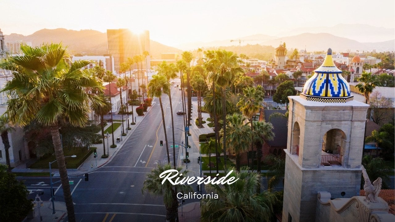
Downtown Riverside – Mission Inn, museums
Palm Springs – resorts, shopping
Orange County beaches – coastline, surfing

What's the best place to rent a car if I'm staying in Moreno Valley?
If you're flying in, you'll find the most rental companies at Ontario International Airport (ONT). It's the closest major airport, about 25 miles (40 km) northwest of Moreno Valley. For better prices, you can check out the Enterprise or Hertz locations right in Moreno Valley, but you'll need a way to get there.
Do I need a special type of vehicle for driving in the Moreno Valley area?
Any standard car will work fine for driving around Moreno Valley and nearby cities. However, if you plan to visit mountain areas like Big Bear Lake or Idyllwild, you should get an SUV or a car that has more power for the steep roads. This is especially true in winter when it might snow. In the summer, make sure your car's air conditioning works well since temperatures often get over 100°F.
How is the traffic in Moreno Valley compared to Los Angeles?
The traffic in Moreno Valley is heavy but usually more predictable than in Los Angeles. Highway 60 is the main road going east and west. It gets very busy during the morning rush hour going west and the evening rush hour going east as people drive to and from Los Angeles. Traffic inside Moreno Valley itself is usually manageable, except on major roads like Alessandro Boulevard and Perris Boulevard during the busiest times.
What are the parking options in Moreno Valley?
You can usually find plenty of free parking all over Moreno Valley. All the major shopping centers, like Moreno Valley Mall and Towngate Shopping Center, have free parking lots. You can also park on most streets for free, but watch for signs in certain areas or on street sweeping days. Unlike in bigger cities, you will rarely have trouble finding a parking spot in Moreno Valley.
How far is Moreno Valley from major Southern California attractions?
Moreno Valley is in a central spot, so you can easily get to many attractions. It's about 65 miles (105 km) from Los Angeles (1–2 hours depending on traffic), 45–55 miles (72-88 km) from Orange County beaches (1–1.5 hours), 50 miles (80 km) from Palm Springs (45–60 minutes) and 65 miles (105 km) from Joshua Tree National Park (1–1.5 hours). Its location makes it a great starting point to explore different areas.
Are there any toll roads in the Moreno Valley area?
You won't find any toll roads right in the Moreno Valley area. The closest toll roads are in Orange County (SR-73, 133, 241 and 261), which you might use if you drive to the coast. You don't have to pay to use the major highways that connect Moreno Valley to other cities, like Highway 60, I-215 and Highway 91.
What should I know about driving in the summer heat?
In the summer, from June to September, temperatures in Moreno Valley often go above 100°F. Make sure your rental car's air conditioning works well. Never leave people or pets in a parked car, even for a short time. The inside of a car can get dangerously hot very quickly. You should use a windshield sunshade if you park in a sunny spot. It's also a good idea to keep water in your car, especially if you're taking a longer trip.
Can I easily drive to Big Bear Lake or other mountain areas from Moreno Valley?
Yes, you can easily drive to the mountains. Big Bear Lake is about 55 miles (88 km) away, and the drive usually takes 1.5 hours using Highway 60, I-215 and Highway 330/18. To get to Idyllwild, you can take Highway 60 and Highway 243 from Banning. These mountain roads are curvy and steep, but crews keep them in good shape. In the winter, you should check the road conditions because you might need chains for your tires during or after a snowstorm.